Mapit GIS - Map Data Collector
5억명 이상의 게이머가 신뢰하는 안드로이드 게임 플랫폼 BlueStacks으로 PC에서 플레이하세요.
Run Mapit GIS - Map Data Collector & Measurements on PC or Mac
What’s better than using Mapit GIS – Map Data Collector & Measurements by Mapit GIS LTD? Well, try it on a big screen, on your PC or Mac, with BlueStacks to see the difference.
About the App
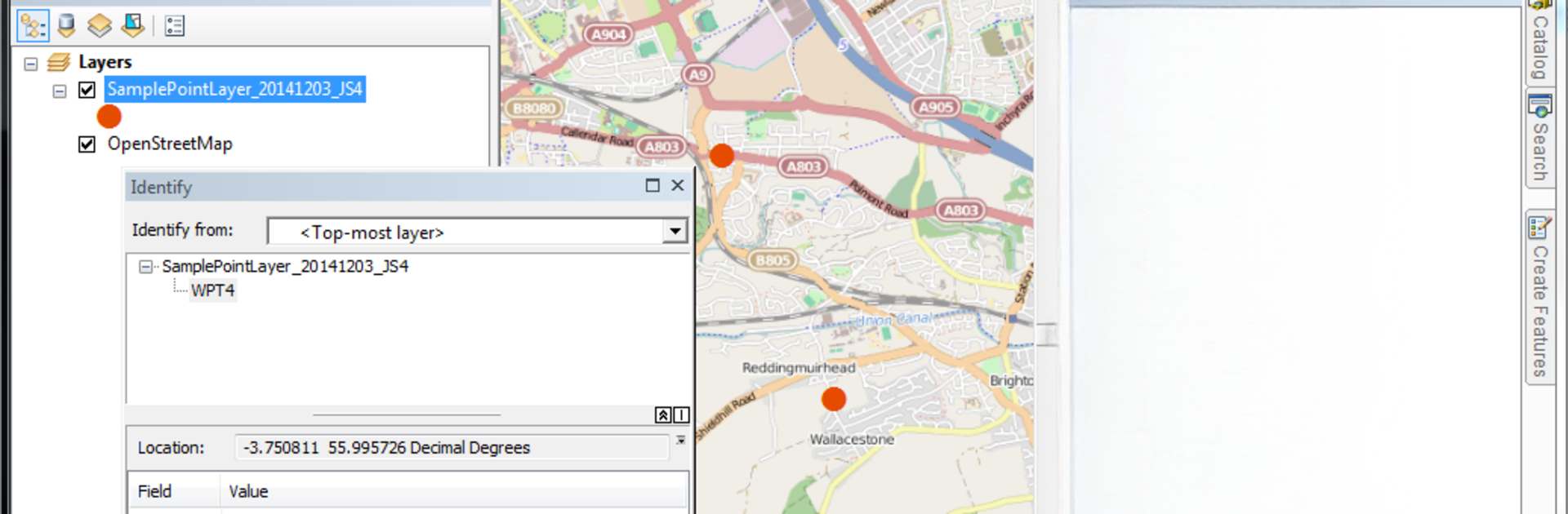
Need a reliable way to collect and manage mapping data right from your device? Mapit GIS – Map Data Collector & Measurements from Mapit GIS LTD helps you streamline your fieldwork, whether you’re surveying, measuring land, or mapping out multiple locations on the go. It’s flexible enough for lots of different jobs—agriculture, construction, environmental work, and beyond. You can count on Mapit GIS for precise location data and smooth handling when you’re out in the field or back at your desk reviewing everything you’ve collected.
App Features
-
Work Your Way, Online or Offline
Toggle between popular online map sources or load up offline mbtiles so you’ll never lose access to base maps, even without a signal. -
Flexible Data Collection
Capture points, lines, and polygons however you like—use GPS/GNSS, tap directly on the map, trace as you go, or work with angle and distance for pinpoint accuracy. -
Survey Layers & Custom Attributes
Keep things organized by grouping your data into layers. Set up custom attributes as dropdown lists, save time, and re-use these choices across different projects. -
Seamless Sharing & Compatibility
Export your surveys in a bunch of formats—Esri shapefiles, CSV, KML, geojson, GPX, DXF—so everything slots right into your desktop GIS tools like qGIS. -
High-Precision GNSS Support
Hook up external GNSS receivers by Bluetooth for even more accurate coordinates. Need RTK-corrected positions or specific coordinate systems? You’re covered. -
Simple Measurements
Instantly calculate area or distance just by drawing shapes. Handy when you’re measuring fields, lots, or routes on the fly. -
Easy Data Management
Import points, lines, and polygons from files, or back up your data quickly. You can even attach photos to your features and import long attribute lists to speed up entry. -
WMS & GIS Server Access
Bring in extra detail through WMS services—topographic, cadastral, geological maps, and others are just a few taps away. -
Device & Storage Flexibility
Save and export data to your SD card, Dropbox, or via FTP just as easily. Clusters for large point datasets help keep your maps fast and snappy. -
Satellites & GPS Status
Check on satellite signals and GPS accuracy in real time, making it easier to know when your data is really spot-on. -
Location & Address Search
Find places right away with built-in address and location search so you’re never stuck manually scrolling around.
Using Mapit GIS – Map Data Collector & Measurements on a big screen with BlueStacks makes handling complex map data even simpler. Great for fieldwork—and for dealing with the mountain of info you bring back after.
Switch to BlueStacks and make the most of your apps on your PC or Mac.
PC에서 Mapit GIS - Map Data Collector 플레이해보세요.
-
BlueStacks 다운로드하고 설치
-
Google Play 스토어에 로그인 하기(나중에 진행가능)
-
오른쪽 상단 코너에 Mapit GIS - Map Data Collector 검색
-
검색 결과 중 Mapit GIS - Map Data Collector 선택하여 설치
-
구글 로그인 진행(만약 2단계를 지나갔을 경우) 후 Mapit GIS - Map Data Collector 설치
-
메인 홈화면에서 Mapit GIS - Map Data Collector 선택하여 실행