Upgrade your experience. Try Map Pad GPS Land Surveys & Measurements, the fantastic Productivity app from Mapit GIS LTD, from the comfort of your laptop, PC, or Mac, only on BlueStacks.
About the App
Here’s a straightforward way to measure land, plan routes, or map out any space you need—welcome to Map Pad GPS Land Surveys & Measurements from Mapit GIS LTD. If you want to figure out the size of your backyard, check distances for a construction project, or save your survey data for later, this Productivity app has you covered. With a flexible toolset and clear visuals, Map Pad just simplifies mapping—no matter if you’re on the job or just out for a hike.
App Features
-
Instant Area & Distance Calculations
Quickly draw shapes or paths right on the map and Map Pad figures out the area or distance for you. You can also track real-time with GPS—handy whether you’re measuring farmland, planning a run, or mapping out a new fence line. -
Reliable Maps & Views
Switch between Google Maps (with satellite, terrain, or hybrid views), Bing Maps, or Open Street Map. There are even overlays for things like topographic maps or custom layers, so you get the info that’s most useful for your project. -
Flexible Measuring Tools
You’ve got options: tap points on the map, use your GPS, or move the cursor to set measurements. You can work with metric or imperial units, plus several coordinate systems for different countries or technical needs. -
Export, Save, and Share
Send your data anywhere you need it. Export measurements in SHP, KML, GeoJSON, CSV, GPX, DXF, and more—straight to your device or cloud accounts like Dropbox and Google Drive. Need to show someone else? Share points by text or email. -
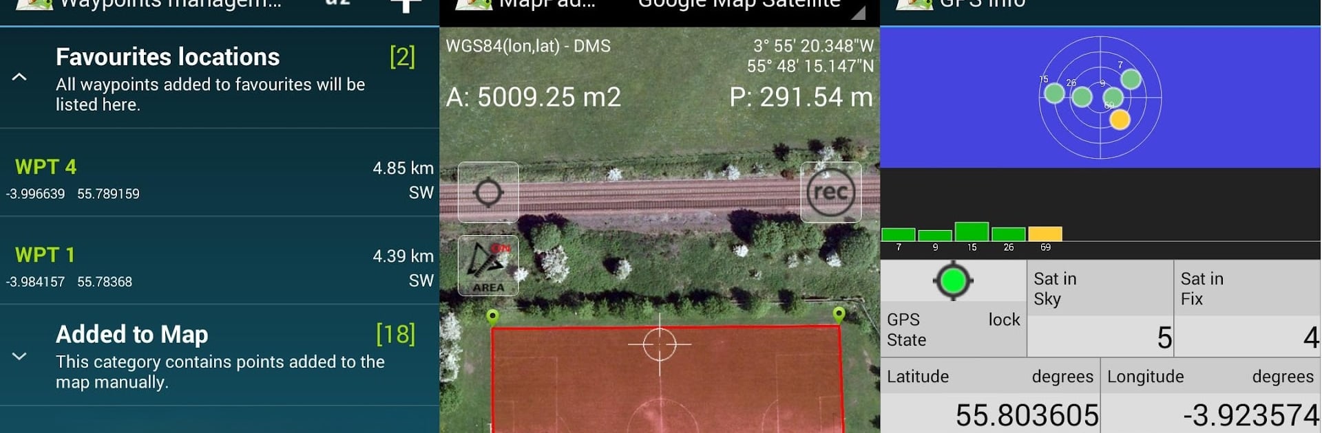
Custom Waypoints & Notes
Capture waypoints along your route, sort them into categories, and add details with titles and descriptions. It’s super helpful for real estate surveys, tracking assets, or managing long lists of locations. -
Elevation & Navigation Features
See elevation profiles for your GPS-tracked measurements and check your GPS or satellite status anytime. There’s also a handy address and location search to help you get where you need to go. -
Configurable to Your Workflow
Set up the app the way you need it—choose measurement units, adjust map overlays’ look, fine-tune data intervals, or personalize waypoint colors.
Want to run Map Pad GPS Land Surveys & Measurements on a bigger screen? BlueStacks lets you do just that, making it perfect for more involved mapping days or long-term survey projects.
Eager to take your app experience to the next level? Start right away by downloading BlueStacks on your PC or Mac.